

CLIMBING LA TORRECILLA
To the south of Finca La Donaira the villages of the Grazalema Natural Park are linked by a network of drover’s paths which wind through groves of olive, almond and ancient stands of holm and gall oaks. From here a vast forest of cork oak stretches nearly all the way to Gibraltar whilst, out east, a high massif rises majestically above Ronda. This is La Sierra de las Nieves, a UNESCO biosphere reserve which, as the name implies, is often blanketed in snow during the winter months.
The park’s most challenging trail, and one close to my heart, leads to the summit of La Torrecilla (1919m). This is the massif’s highest peak and from the summit you’re treated to one of the most bone-thrilling vistas to be found in Andalucía. The 360 degree panorama encompasses the Sierra Nevada, a long stretch of the Mediterranean coast, Málaga, Gibraltar and the Strait, whilst on clear days the Rif mountains of northern Morocco rise hazily above a glittering sea.

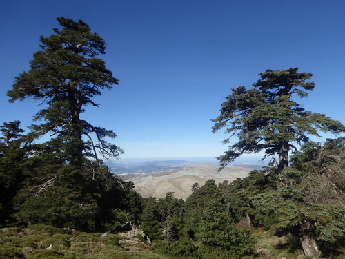
*Spanish Fir, Abies pinsapo
The adventure begins with a drive along 10km of rutted track which bring you to the trailhead and the mountain refuge of Los Quejigales. Crossing a narrow bridge that spans a babbling stream – it can become a torrent in the winter months – your first challenge comes in the form of a rocky path which zig zags steeply up through the largest stand of Spanish firs or pinsapos in the sierra. These Ice Age relics are the botanical jewel of the park, a species found only in Andalucía, the Moroccan Rif and remote parts of the Caucasus. The forest is a sculptural wonderland of twisted trunks, some up to 30m in height. It’s even more beautiful when the ancient trees are cloaked in the mist that often licks round the mountain early in the day.
Breaking out of the forest you reach a high, windy ridge as the Mediterranean comes into view. Here the trail loops north then back south before adopting a course towards La Torrecilla. Passing an ancient ice pit the path runs through a swathe of gall oaks. The forest suffered greatly at a time when its wood supplied the shipyards of the Atlantic coast: the tiny caravel that carried Columbus west to America was almost certainly built of oak from the Ronda mountains. Further devastation came at the hands of charcoal burners who worked the forest until just 50 years back. The trees are now a protected species and thriving once again, aided by restrictions placed on the grazing of goats.
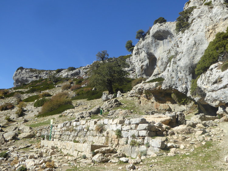
*El Pilar de Tolox
The waymarked trail runs on past the entrance to the pothole Sima GESM. Explored to 1100m, this is one of the deepest potholes in Europe and was discovered just 40 years ago. Here the path crosses a series of flat-bottomed dolines, or depressions in the limestone, their baize-like grass strangely reminiscent of neatly-tended golfing greens. Cutting through a cleft in the rocks you come to the spring and Roman drinking troughs of El Pilar de Tolox. This is the place to replenish your water bottle before tackling the final 200m of ascent to the summit, now high above the tree line.
After gulping in the dizzy views from this extraordinary natural mirador you need to retrace your footsteps back down to the ice pit passed early in the walk. From here a second path loops further north, leading down through a second stand of magnificent pinsapos, to bring you back to the trailhead after some six hours of exhilarating trail. It’s a hike that’s not only fascinating from a botanical and historical perspective but one that takes you to the heart of one of the wildest tracts of mountain terrain in southern Spain, a must-walk should you come to explore the trails close to La Donaira.
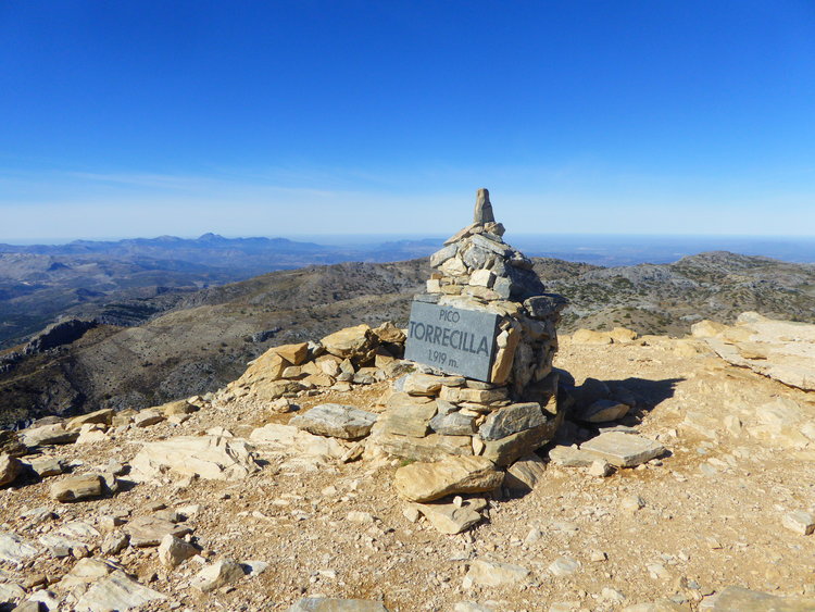
*The Summit
